
There are just three hills in this group which count as Simms but not Hewitts: two in the Berwyn, and another south of Rhyader.
That last one, Y Gamriw (1977ft), still awaits me, but I picked up the other two as a curtain raiser to the 2026 Essex & Herts LDWA weekend in Church Stretton.
Cefn Perfedd from Cynwyd and descent to Corwen: Thursday 26 March 2026, 11 miles
Cefn Pefedd (1971ft) is one of those annoying Simms that I had been very close to before, in this case on the round of northern Berwyns in 2015.
It can be climbed as a simple out-and-back from Cynwyd but as I was staying in Corwen I dropped down there to effect a transit of the hill instead. Indeed, as an old rail track links start and finish, this could quite easily be a 13 mile circular walk, but there was a well-timed bus that allowed me to miss what would be an uneventful two miles.
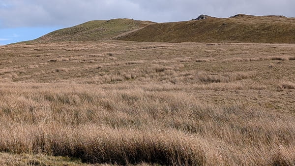
Ascent is simple by forestry tracks, though at a choice of gates on leaving forestry I picked the wrong one. I soon realised and a simple fence-hop put me back on track. The top itself, about 150 yards from the path in 2015, is just a patch of heather.
But there was one great compensation. There had been snow showers the day before, with the snowline just over 2000ft, so the views to Cadair Berwyn and its neighbours were glorious.
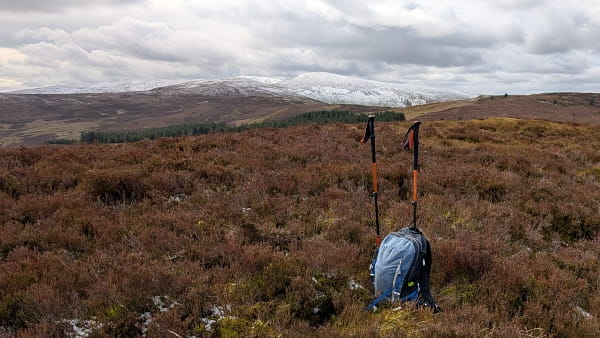
The summit of Cefn Perfedd
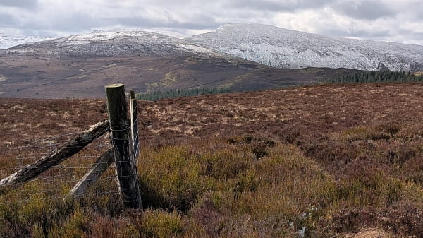
From the fence boundary, with a better view of the Berwyns
To reach Corwen, I joined the 2015 path in reverse, over Cerrig Coediog and down to the bwlch with the Hewitt of Moel Fferna. To reach Corwen, I branched right a mile or so from the bwlch, the odd track helping me avoid most of the heather, to a network of paths above the forestry. These led to the ruins of Liberty Hall, and thence down to Corwen, with no difficulty – and views of the snow-capped high hills of Eryri in the distance.
The high hills of Eryri from Liberty Hall
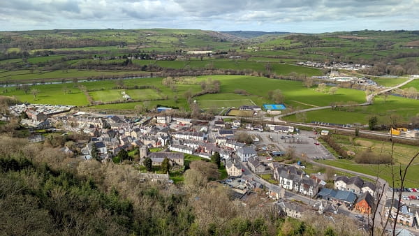
Corwen, from the viewpoint of Pen-y-Pign
Glan-Hafon from Llangynog: Friday 27 March 2026, six miles
Glan-Hafon (1994ft) is essentially the last outlier of the Berwyns. It rises above the village of Llangynog, once a slate-mining centre with many relics of this activity still visible on my ascent.
OS maps are wrong shock! I walked straight past the start of the bridleway off the valley road at 056263 because OS shows it about 250m further along, where there is nothing. It was no problem to take an alternative at Tai-uchaf, but I was surprised, at the path junction where my planned route came in, for the bridleway onwards to disappear into bracken. Maybe the odd tread in reassurance, but in summer when the bracken regrows this would be a bushwhack.
Things are much better over the Nant Sebon, and after leaving its cwm, I was delighted that my pathless route to the hill was for the most part an easy stroll. Indeed Glan-Hafon’s top is grassy; the summit though is not the trig point, but a grassy knoll to its west.
Views to Cadair Berwyn were good, but almost all the snow which I had seen from Cefn Perfedd yesterday had gone.
For descent I thought it might be OK to just drop down S through access land, taking care to avoid crags before reaching a right of way. Alas the grass didn’t last, and by the time I was above the crags thick gorse presented itself. I edged right, and kept above a little patch of scree, only to see an unmarked barbed-wire fence in my way. I keep cable tidy ready for this sort of thing, but it was an annoyance.
The right of way from Mochnant back through farmland wasn’t always in great shape but it got me back to the road that had taken me out of Llangynog.
I’m unlikely to be back on the hill but I’d certainly look for a better way off if I were.
The summit ridge of Glan-Hafon
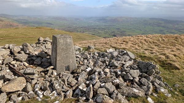
Glan-Hafon trig point, looking east