
The Hoo Marshes apart, this section is a rare mix of the urban and the industrial, with a creek or two to hark back to older times.
The industrial, as ever, one has to take on the chin. It can be downright ugly, but that’s not the point; and I’ve always thought, with the right lighting, it brings if not beauty than at least interest. And it brings jobs.
The urban ranges from some fairly unlovely south-east London sprawl to the Medway towns of Rochester, Chatham and Gillingham. The Medway estuary long held an important place in British naval history, notably at Chatham; meanwhile Rochester, with cathedral, castle and two museums is now firmly embedded in heritage England.
And there wide open spaces too, notably on the Hoo Marshes, though I’m looking forward to discovering the area round Little Halstow too.
For I’ve not quite finished this stage. I’m at Rainham, waiting for completion of the England Coast Path from there to Swale. For me it’s a short day, and hopefully I can combine it with a circumnavigation of the Isle of Sheppey, its own ECP also almost ready.
Monday 28 January 2013: Erith to Woolwich, 7½ miles
No thought of the England Coast Path then, for it hadn’t been invented. But, then as now, the Thames Path was busy appropriating the south bank of the river east of the Woolwich Flood Barrier as its own, and it still is, sort of. I was still four years away from completing the TP but wanted to check out this section of the trail, and it’s described here.
Note that I’d walked this section ‘backwards’ compared to my normal Kent Coast direction, because I was walking the Thames Path from sea to source. Also, in those days the revised Thames Path ‘start’ was at the Darent Flood barrier, so I’d started from Slade Green station as the easiest access, giving an 11-mile walk in total.
Friday 20 July 2001: Erith to Barnes Cray, 4½ miles
This for me was the first stage of the London Loop, part of a day that took me 15 miles to Petts Wood. Not interesting enough to merit re-walking 20+ years on, but there’s a smidgeon more information here.
Wednesday 28 May 2025: Barnes Cray to Gravesend, 13 miles
There’s a mile walking back along the River Cray to start with, before crossing the River Darent and walking on its eastern bank, up to the river’s flood barrier. This is a major reason why I’d not started again at Erith: there’s five miles of walking to get from one side of the barrier to the other, which is the sort of thing that can happen with coastal walking, and you don’t want it to happen more than you can get away with.
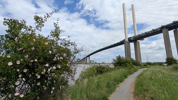
From the barrier, the Thames runs pretty straight for four miles, crossing under the Dartford Bridge. There’s no obstructions to the path, so this is straightforward walking. I spent part of the time wondering where we’d come ashore on a stage of the 2017 Silk River walks – turns out I was unusually wrong in my memories; we’d landed on shingle not at a jetty, then headed for Dartford rather than walked by the river.
Darent flood barrier, from the eastern side
The Dartford bridge
There is, of course, a lot of industry, on both sides of the river. There’s an urban interlude at Greenhithe, though little of its maritime heritage remains, before heading out to the Swanscombe peninsula. This is post-industrial land, and something now of a wildlife haven. It’s threatened, of course, first by a theme park proposal a few years ago, now by housing. If they house people here the 623ft electricity pylon, carrying 400kV power cables to a twin on the Essex bank, might serve as the local landmark. What might happen to the little boating community at Broadness, heaven only knows.
There are fewer hints of wildlife for the last three miles or so into Gravesend. New housing at Northfleet and Rosherville forced diversions; in between, paper processing is the Big Thing, with a tower proudly boasting an Andrex advert at its top. Gravesend itself comes quite quickly; it’s a compact town centre, which I had explored on a later Silk River day, but alas since then the centuries-old ferry to Tilbury had ceased operation, a victim of local government ‘austerity’.
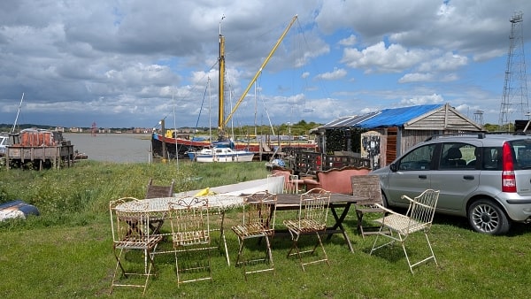
Boatyard at Broadness
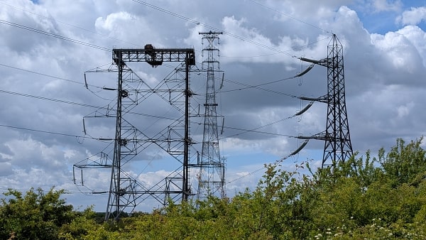
The Swanscombe pylon
Monday 17 February 2026. Gravesend to Allhallows-on-Sea, 18 miles.

Gravesend town pier and the Thames
I’d long looked forward to this stage, which ranks as one of the longest habitation-free stretches of the entire ECP.
By ‘habitation’ I include industry. There’s a fairly grubby mile of it leaving the town pier at Gravesend, but then there’s dike-top (or close by) walking all the way on the edge of the Hoo Marshes until a bit of farmland just outside Allhallows.
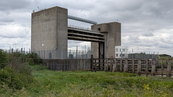
From time to time, the Thames estuary has been regarded as a potential weakness in defence of the British realm, and jitters about French intentions in the 1860s led to the building of two forts a few miles downstream from Gravesend, Shornemead Fort and Cliffe Fort (and two more at Tilbury across the water).
Despite many formal safeguards they are a bit unloved now; Shornemead badly grafittied, and Cliffe almost engulfed by still-active gravel workings.

Shornemead Fort

Cliffe Fort
For me, with my Essex leanings, the eye was drawn continually across the Thames. I had a good time of spotting landmarks from this fresh vantage point. One that can’t be missed is the London Gateway port complex, at once both a usurper to the Tilbury docks and a rival to Felixstowe.

The ECP goes straight through the gravel workings at Cliffe Fort

London Gateway port
There had been mud and puddles intermittently to Cliffe Fort, but beyond things improved dramatically – at first on a track, then on a beautifully grassy dike top that made for easy going, aided by a following wind. Just as well: I was on a mission. My overnight was in Rochester, and that meant a long bus journey from Allhallows.
A fast train transfer in London meant a slightly earlier start than planned, which in turn brought earlier buses into play. Could I save an hour? As the miles clicked by, it had to be possible.
So I kept pounding on, shrugging off a sharp hail shower but keeping note of the views. In Essex, Hadleigh Castle, Leigh and Southend; over to my right, grazing marshes, but also the village of Cliffe on its little hill (there’s a reason the Saxon Shore Way heads through it), and military relics too, a WWI munitions factory and a WWII dummy oil storage depot.
I had super-clean boots by the time I reached the farmland on the edge of Allhallows-on-Sea, but that didn’t last thanks to a greasy headland and mucky hedge gaps. Never mind. Forget saving an hour, I’d saved ninety minutes and hence a more direct bus. Whoopee. A cheery wave to the gateman at the holiday park, with ‘See you tomorrow’, and enough time to unpeel the leggings before the bus.

Southend from Allhallows
Tuesday 17 February 2026: Allhallows-on-Sea to Rochester, 17 miles.
Hello again to the gateman, and back to the coast for a couple of miles; more of the same from yesterday, until a road walk into Grain village.
This was pretty much the highlight of the day. From the coast at Grain, there are plenty of inviting paths heading south around the peninsula, but they come to a juddering halt when industry is reached. Here be gas and oil storage tanks, a concrete works, a power station, a cargo dock. The ECP has managed its way around similar elsewhere, but drawn a blank here. The official advice is: ‘Take the 191 bus to Grain Crossing’, where the industrial site ends.
I knew this of course, and had planned a sandwich stop in the village. Indeed I had time for a pint at the village pub, perfectly decent place if you channel out a guy’s ‘I’m not a racist but …’ diatribe. There isn’t actually a bus stop at Grain Crossing, but the driver let me off anyway.

Allhallows-on-Sea

Grain oil terminal and dock
From here there’s a nice three dike-top miles by the Medway before the ECP is forced inland, thanks to more industry and another (but now defunct) power station. It’s OK through the village of Stoke but distinctly humdrum thereafter.
Once reached, the coast now feels estuarine rather than marine, as the Medway channel narrows. At Lower Upnor, there’s a choice to be made, for the ECP now takes the tidal foreshore. At high tide that means a diversion, but for me it’s well into ebb, and though it’s a bit slippy and sucky at times, it feels like ‘proper’ coast walking for once.

Lower Upnor

The foreshore at Lower Upnor
There’s a short uphill, which hides the Tudor-era Upnor Castle, before a drop down through the rather bijou village of Upper Upnor. That’s the last highlight of the day: it’s suburban walking in the gathering gloom into Rochester itself.
Wednesday 18 February 2026: Rochester to Rainham, 12 miles (11 on ECP)
Roughly half of this is urban and half not.
There’s one great highlight on the first half, and that is the Historic Dockyard at Chatham. The dockyard, for 400 years a major base for the Royal Navy, closed in 1984 and many of its buildings and services have been repurposed as a visitor attraction – I remember visiting when our boys were young sometime around 2000. Today being in half term, there were plenty of other families doing the same.

Rochester Cathedral

Chatham Historic Dockyard
North of here, a promontory known as St Mary’s Island has become an extensive area of housing; the ECP circumnavigates it. I spent my time walking round it wondering if it was a successful and thriving community or another failed attempt at regeneration. Something to think about at least, in contrast to the kilometre or so beside a fast dual carriageway that follows it.
That stretch ends at a large Asda supermarket, its front entrance directly on the trail. That was no bad thing, for its café was well-timed for elevenses. Some wandering around more new housing plus another bit of dual carriageway led at last away from the urban and onto a proper estuary path.
Soon it passes the Strand Lido, an unheated saltwater pool that’s one of a few of its kind. Beyond, there’s interest across the marshes, with a few marsh islands and the Horrid Hill promontory, named apparently for the working conditions at its cement works. The whole area is part of a country park which today was busy with walkers, runners and birders.
Though the ECP doesn’t divert onto Horrid Hill, it does loop out onto a more substantial promontory, known as Motney Hill. Its northernmost tip is a sewage works and thankfully the Path doesn’t circumnavigate that.
And that, more or less, was that. At the time of writing, the ECP ends at a footpath junction just short of Otterham Creek. It’s been difficult, it seems, to fix the line from here the 11 miles or so to Swale – the Saxon Shore Way can be followed, but the ECP needs to be closer to the shore.
So for me, all that was left was to walk through a hop field and then along a suburban road to the station at Rainham. Half that field seemed to be being readied for development, so what this might look like when I return I do not know.

Dual carriageway before Asda

The hop field at Rainham