
When I started checking out the Simms-but-not-Hewitts as a possible successor to the Hewitts, one of the things that attracted me was the possibility of a wild camp on Dartmoor.
The moor is the only place in England and Wales where there is a legal right to wild camp. It had to be fought for in the 2020s, after a Ukip-supporting, Brexit-loving hedge fund manager called Darwall spent £££ trying to stop people’s simple enjoyment of the outdoors. Hoorah for the law. He lost.
There are three Simms on Dartmoor. High Willhays is also a Hewitt, and it was a target on my cross-England walk. Cut Hill and Hangingstone Hill lie to the south, in wilder country.
Saturday 9 and Sunday 10 August 2025: Cut Hill and Hangingstone Hill from Okehampton, 9½ and ten miles
These two hills are about three miles apart in central Dartmoor, with the East Dart River in between.
That seemed to be crying out for a wild camp, easy access being provided by the Dartmoor Railway to Okehampton, re-opened in 2021. Just a week after coming back from completing the Hewitts on Great End, a decent weather forecast was too good an opportunity to miss.
Okehampton station is on the southern edge of town, so it’s practically on the moor itself. My way south lay through the army camp, which has a right of way running through it, though in the summer the squaddies are largely absent (and most importantly, there are no army exercises on the moor itself).
One benefit of army use of the moor is that they have to build tracks to get their vehicles in and out of their redoubts. This helps the ordinary walker no end. For me, there was simple walking for half of Saturday and most of Sunday.
This is just as well. The moor’s ecosystem is in crisis, with purple moor-grass the culprit. It’s not strictly an invasive species, as it’s native, but as peat dries out, it gains new footholds. Much of the area around Cut Hill is covered by it, and it’s a nighmare to walk through.
Anyway, back to the walk. On this pleasant summer Saturday, there were plenty of walkers heading for High Willhays, its neighbour Yes Tor, and many other of the local high points. There were fewer though as I headed south to Dinger Tor, where the central moor unfolded itself.
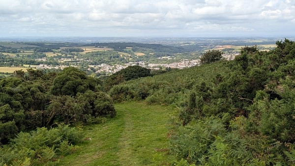
Looking north over Okehampton
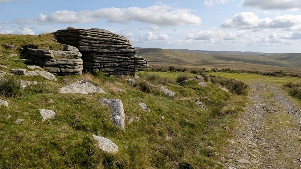
Dinger Tor
Here the army track ends, but I was pleased to find a decent path heading south for another half-mile or so. Dropping down to the West Okement River and climbing up to Great Kneeset – great name! – wasn’t too bad either, but then the purple moor-grass started to take over. It’s akin to walking through tussocky heather, but without the purple balm.
Any sheep track heading roughly in the right direction was gratefully taken, but they were all false gods. Despite plotting a route which avoided peat hags wherever possible – in truth, they were barely a problem – progress was slow.
And Cut Hill (1981ft) was no sharp prominence. Its off-route neighbour Fur Tor boasted tors a-plenty, but my target was just a puddingy lump. Still, I got there, and at least someone has dragged a few stones from goodness knows where to make a cairn.
Now I needed to find a camp spot, which meant dropping down to the East Dart River for water and, hopefully, some relief from the moor grass. Eventually I realised that the sensible thing to do was find the boundary between the Okehampton and Merrivale army ranges, which boasts some sort of path, but after a while this headed too far south.
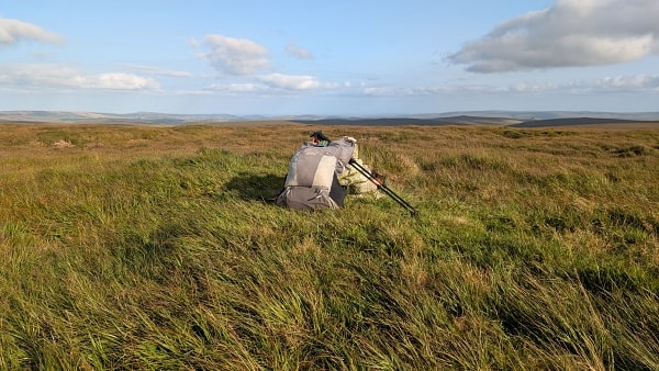
The first encounter with the river was not hopeful, as it ran sluggishly through marsh. Any chance of firm ground clearly would lie downstream. Thankfully, it came sooner than I had feared – a wonderful stretch of level grass, big enough for two or three tents if needed. I was soon settled in for the night.
Cut Hill summit
The wild camp
Saturday had seen sunny intervals; I woke on Sunday to full sun, no wind, and enough midges to make striking camp something of a dance.
No matter. There was a clearish path by the river for a good mile or so, but eventually I had to strike half-right towards the ridge that bore Hangingstone Hill (1984ft). The ridge I knew bore army tracks and hence some relief. Safely on them, I had a wander round Whitehorse Hill, just south of its neighbour, as it’s just over 600 metres too and I wanted to avoid having to return should it get promoted.
I’d seen no-one all morning (two and a half miles in one and a half hours – thanks moor-grass) but I’d only been on Hangingstone Hill a few minutes when a party of around ten turned up. They’d been wild camping too, which is nice, but that must have been four or five tents at least and to me wild camping means just one or two. Still, I’m not going to tell Mr Darwall. But from now on the hills were alive.
A dip through Steeperton Gorge let me refill with water, the River Taw tasting far more pleasant than the East Dart had.
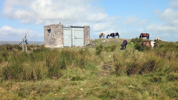
Hangingstone Hill summit – horses and army post
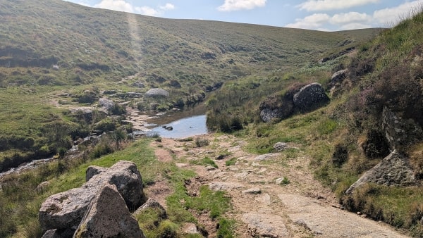
The River Taw in Steeperton Gorge
On Oke Tor, the next salient north, I met a large Ramblers-style group of two if not three dozen, some daringly scaling the rocks while others, on what was becoming a warm day, lazed in the sunshine below.
My target now was the Tarka Trail, a long-distance path that links Dartmoor and Exmoor. Though by now walking on the moor was easy, I thought that a popular LDP like this one would speed my return to Okehampton. Yet after crossing the East Okement River, it was anything but. The path in the wooded gorge beside the river was riddled with tree roots, sharp up and downs, awkward wriggles and in a couple of places diversions to escape eroded sections of path.
Still, I was in no rush, having long planned to hit the pub in Okehampton for food and drink before my train home. Tarka Trail signs got a bit confusing in the town itself – maybe I missed something – but its Fairplace square had good benches where I could strip off the boots and generally cool down a bit before a couple of pints of Dartmoor’s finest ale.
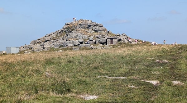
Oke Tor
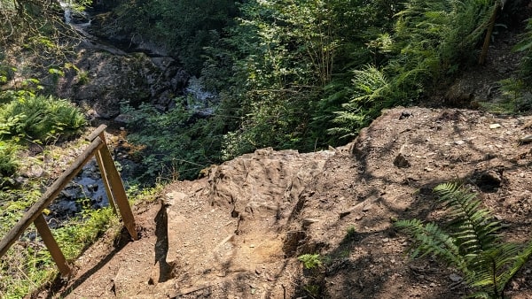
Eroded path on the Tarka Trail